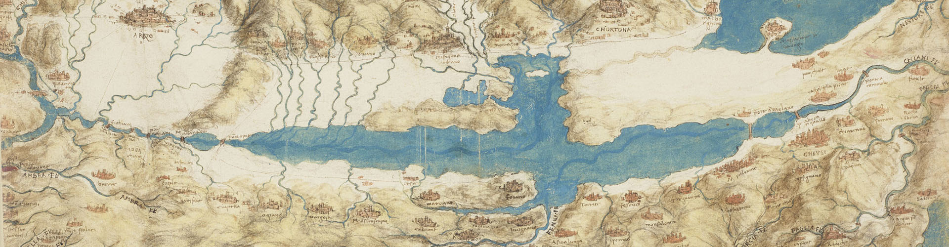
In 1502 and 1503 Leonardo da Vinci traveled across Tuscany, drawing up splendid hydrological maps based on precise topographical measurements that reveal a clear intention on his part to develop a water management project for the region’s great plains. The map of Valdichiana (Windsor, RL 12278), drafted when Leonardo was working as architect and military engineer for Cesare Borgia, is a bird’s eye view comprising the upper Valdarno, Arezzo, Lake Trasimeno, the Chianti region around Siena, Volterra, Val d’Orcia, Val di Cecina, and their hinterlands, including the territory of Montepulciano. Numerous place names allow us to identify 254 geographical locations such as cities, castles, and rivers, which the exhibition will explore with multimedia projections and interactive displays.
Leonardo in Valdichiana is a selection of the exhibition Water as Microscope of Nature. Leonardo da Vinci’s Codex Leicester (Florence, Uffizi, 30.10.2018 – 20.01.2019).
The exhibition is organized by the Comune di Montepulciano and the Fondazione Cantiere Internazionale d’Arte di Montepulciano, under the scientific coordination of the Museo Galileo.
Exhibition Dates
| 25.05.2019 – 08.09.2019 | Montepulciano, Fortezza |
-
Related resources